Elevation can make or break your next movement. Knowing how to read the terrain before you ever step off saves energy, avoids mistakes, and keeps you from being surprised by a steep slope you didn’t plan for. But too many people treat contour lines like decoration instead of the critical tool they are.
Most people glance at a topographic map and see brown squiggles—nothing more. They don’t realize those lines hold the entire story of the ground they’re about to cross. Miss the story, and you burn extra energy climbing what you could have skirted, take a harder route than you need to, or run into an obstacle you didn’t expect.
Contour Lines on a Topographic Map

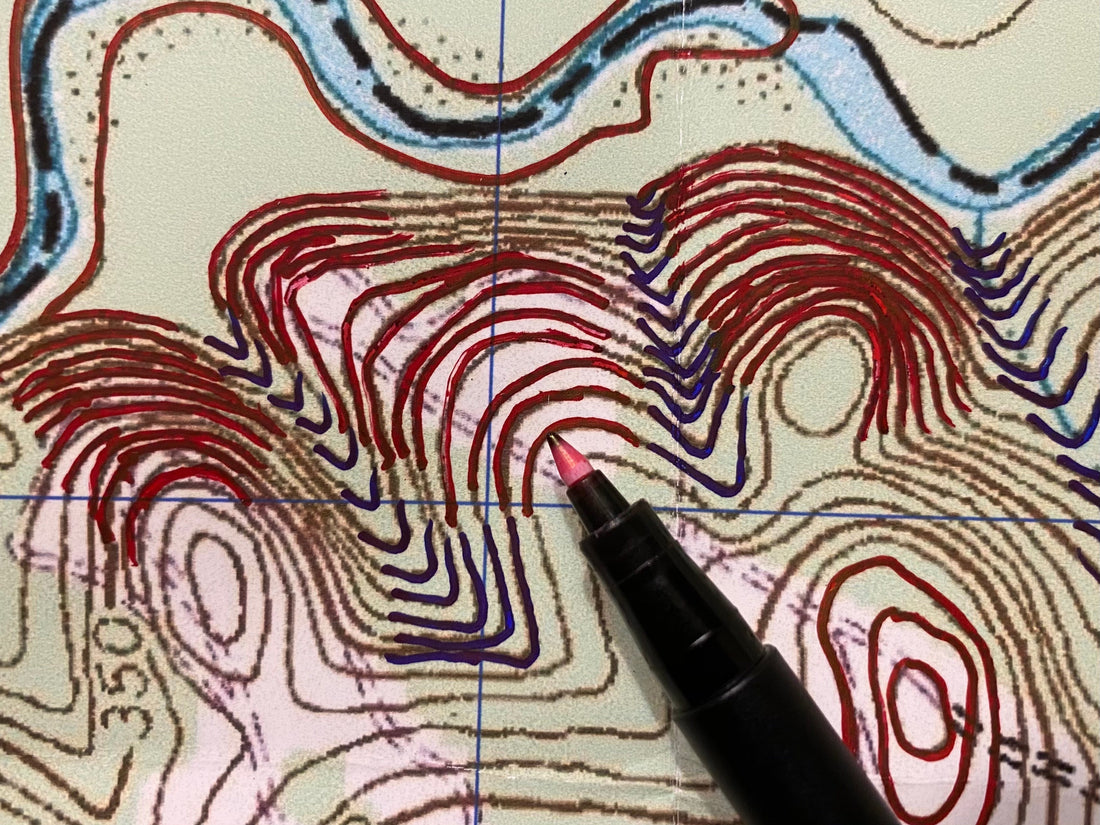
The good news: contour lines are simple once you know the basics. A topographic map uses three kinds of lines to show you elevation and relief:
-
Index Contours — bold lines labeled with elevation
-
Intermediate Contours — lighter lines filling the gaps
-
Supplementary Contours — dashed lines that show subtle terrain in flatter areas
The Contour Interval Note

Your map’s contour interval tells you exactly how much elevation changes from one line to the next — so you know how steep a hill or slope will be before you ever hit the trail. This information can be found in the Marginal Data.
Terrain Features
The shapes these lines make reveal the five major terrain features — hill, saddle, valley, ridge, and depression — and the five minor features — draw, spur, cliff, cut, and fill. Recognizing these shapes helps you plan your route wisely, avoid unnecessary climbs, and find the easiest way to your destination.
Use this knowledge to:
-
Avoid steep climbs when there’s an easier path around
-
Pick routes that follow ridges and gentle slopes instead of fighting the land
-
Spot cliffs, drop-offs, or low areas in advance so you can plan around them
Every time you open your map, you’re training your eye to read the landscape—so you know what’s ahead before you see it.
Critical Map Reading and Land Navigation Gear:
- Rite in the Rain Notebook Cover and Organizer
- Suunto MC-2 Compass
- Topographic Map
- Round Military Protractor
- Pace Beads
- Rite in the Rain Tan Tactical Field Book
- Rite In The Rain Tough Mechanical Pencil
- GB2 Fresnel Lens
Or, bundle and save and get the entire kit for a discount here.

Want to Learn More?
This article is based on our most popular live event (The Original GB2 Master Navigator Course). Get the complete Master Navigator PDF Series—eight field-proven lessons distilled from 30 years of real-world experience by Joshua Enyart. Save when you bundle and start training like a pro. Find Out More Here
The GB2 Tribe Member Streaming Pass unlocks our entire streaming library of training films (over 25 hours and growing). Annual plans get 2 months free. Join the GB2 Tribe today and take your training to the next level!
