


Grid Reference Systems PDF (Master Navigator Series – Part Four)
Grid Reference Systems PDF (Master Navigator Series – Part Four)
Couldn't load pickup availability
Product Highlights
Product Highlights
Fourth in a ten-part progressive land navigation training series
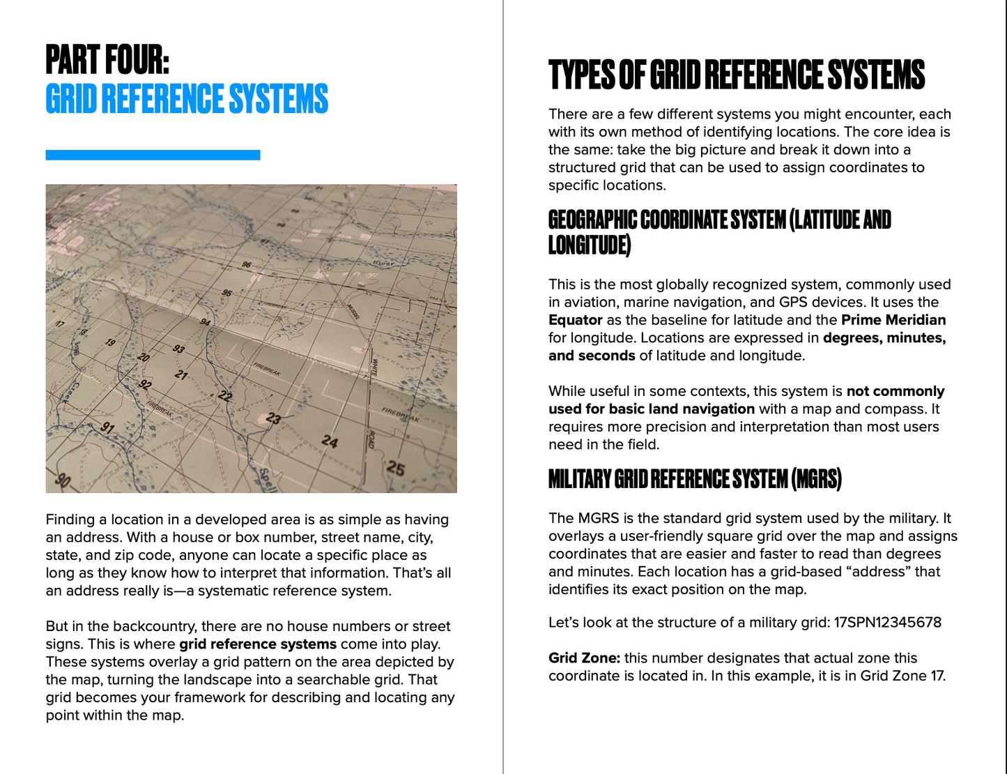
Learn to use grid reference systems (UTM and MGRS) for pinpoint accuracy
Step-by-step instruction on plotting 4, 6, 8, and 10-digit grid coordinates
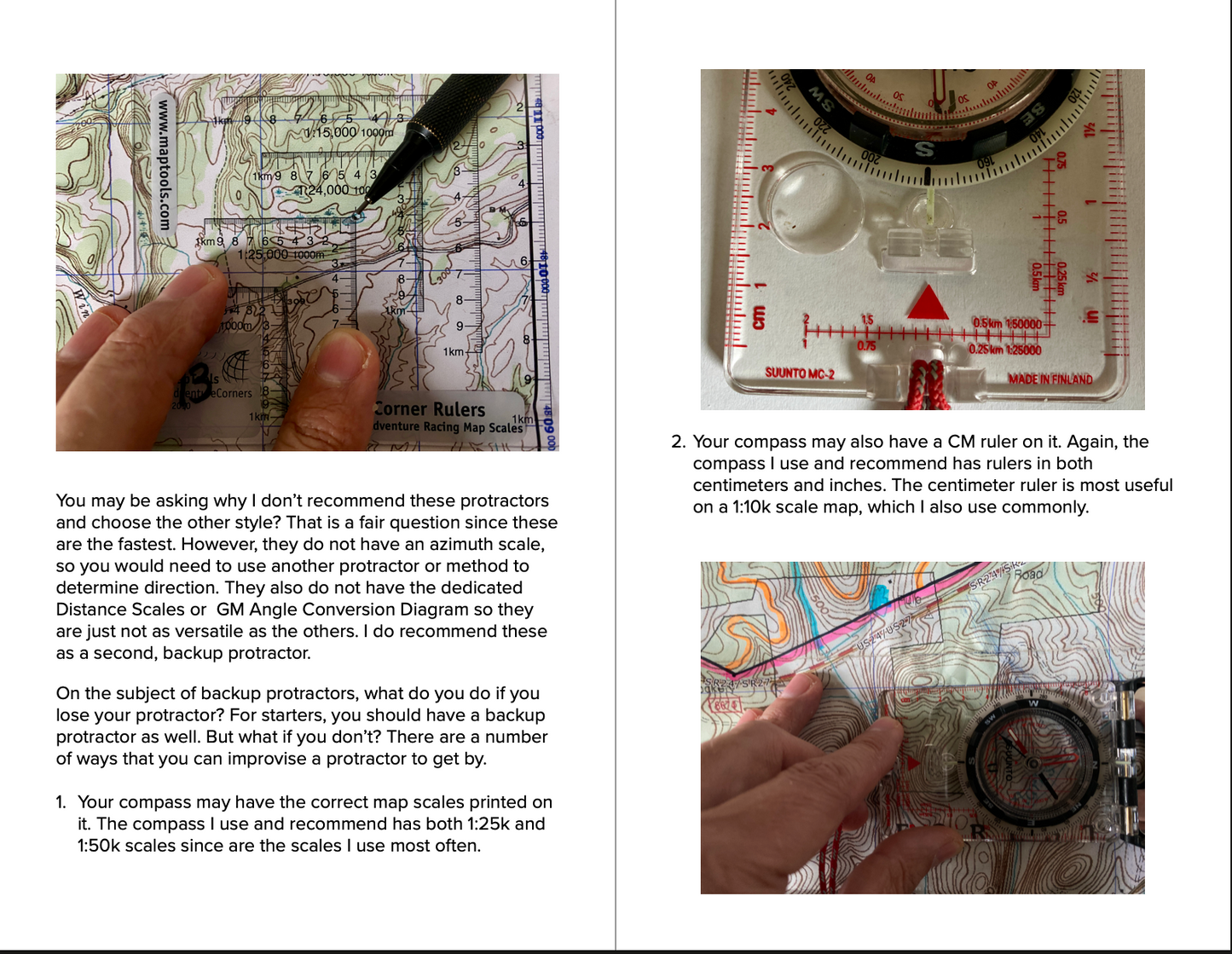
Use protractors effectively with base-10 maps for accurate plotting
Master the universal rule: read right first, then up
Developed and taught by a former Green Beret and Army Ranger
Ideal for tactical professionals, wilderness responders, and serious navigators
Complete the Series
Get All 8 Parts for $39
The Master Navigator™ PDF Series Complete Bundle includes all eight parts — save over $32 compared to buying individually.
Get the Complete Bundle →Master the Language of the Map
Master Navigator Part 4: Grid Reference Systems unlocks the essential skill of precision navigation using grid coordinates. This fourth guide in the 10-part digital series by Joshua Enyart, the Gray Bearded Green Beret, focuses on teaching you how to locate any point on a topographic map using grid systems like UTM and MGRS.
Whether you're calling in a rescue location, planning a route, or finding your exact position in rugged terrain, understanding how to read and plot grid coordinates is non-negotiable. This guide breaks down what grid references are, how to read them accurately, and how to communicate them clearly—especially when lives depend on it.
Train with Real-World Application
Joshua Enyart draws on decades of Special Operations experience to demystify one of the most critical elements of land navigation: coordinate systems. You’ll learn how to use a coordinate scale (protractor), interpret different digit grids (4, 6, 8, and 10-digit), and follow the golden rule of grid reading: “Right, then Up.”
By the end of this guide, you’ll confidently understand the differences between UTM and MGRS, and you’ll be able to plot precise locations on your map—even in complete wilderness.
Key Features
- Fourth in a ten-part progressive land navigation training series
- Learn to use grid reference systems (UTM and MGRS) for pinpoint accuracy
- Step-by-step instruction on plotting 4, 6, 8, and 10-digit grid coordinates
- Use protractors effectively with base-10 maps for accurate plotting
- Master the universal rule: read right first, then up
- Developed and taught by a former Green Beret and Army Ranger
- Ideal for tactical professionals, wilderness responders, and serious navigators
Share